|
A lost village and parish situated on the opposite
side of the River Roding (and the North Circular) from Ilford itself. Domesday Book identifies this as the original location of Ilford and there was a wooden church here in Saxon times, which was rebuilt in
stone in the twelfth century. The brick-built Lethiuellier chapel was added in the eighteenth century. Over the years, Little
Ilford has been eroded as the City of London cemetery occupied its northern part, East Ham absorbed its parish and Manor Park
was the name given to the housing that covered its fields in the 1880s and 90s. This is now an area with problems of social
deprivation. At Little Ilford community school, on Browning Road, more than half the pupils are eligible for free school meals.
Opposite the school is the newly reconstructed London Sri Murugan Temple, a major centre of worship for east London’s
Hindus. The ward of Little Ilford is very ethnically mixed, with no single group predominating. The largest minorities are
white, Bangladeshi, Indian and black African. A third of residents are Muslims and nearly 30 per cent are under 16.
Jack Cornwell Street commemorates a 16-year-old boy from Alverstone Road who was posthumously awarded the Victoria Cross for
his gallantry at the Battle of Jutland in 1916.
|
 |
|
|
|
|
|
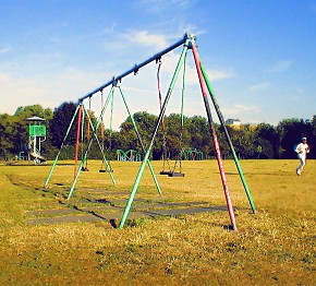
Little Ilford Park, formerly the grounds of Little Ilford Manor, is located at the eastern end of Church Road. It is said
to have inspired the Small Faces’ song, Itchycoo Park – but then so are other nearby parks.
|
|
|
|
|