|
|
 |
|
Lambeth
|
 |
|
An ethnically and socially mixed neighbourhood, often regarded as the northernmost part of Brixton. The name, which referred
to a well-spring by a tree stump, was first recorded in 1197. Stockwell Green formed the focus of the settlement, with the
manor house on its north side and a public well in the south-west corner. The Swan, the Plough and the Old Queen’s Head
were the earliest public houses. The manor house was demolished around 1755 and a new mansion was built, which survived for
less than a century – a period in which Stockwell changed from a collection of nurseries with the usual scattering of
grand houses into a nascent ‘villa land’. William Cox of Kennington began to develop Stockwell Park as a high
class estate after 1838, whereupon several other builders pitched in with variations on his theme. Many of the villas were
terraced or otherwise tightly packed – the secret of their survival to the present day. Several public and philanthropic
institutions arrived here during the 1860s, including an orphanage and a college. Commodious churches replaced cramped chapels.
Stockwell Green was built over in the 1870s despite attempted resistance via the courts. Stockwell became the southern terminus
of London’s first deep tube line in 1890 but it was not until after the Second World War that the landscape was again
transformed – this time by the construction of several large municipal estates, notably the LCC’s Stockwell Gardens
(on the site of Stockwell College), the GLC’s Springfield, and Lambeth council’s Stockwell Park.
 |
 |
|
|
|
 |

|
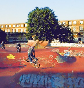
| The Stockwell Park estate |
A third of Stockwell’s residents are black or black British and nearly 15 per cent are non-British white, including
a thriving Portuguese community.
|
 |
|
|
|
|
|
Postal district: SW9
Population: 13,416
Station: Victoria and Northern Lines (Zone 2)
Further reading: Ken Dixon, Alan Piper et al, Brixton Heritage Trails: Six Walks Around Brixton and Stockwell, Brixton Society,
2001
and Edward Walford, John W Brown (editor), Walford’s History of Stockwell and Kennington, Local History Reprints, 1996

Text and selected images are reproduced with the permission
of Chambers but may differ from the published versions
All content © 2005–2010
|
|
|
 |

