|
|
 |
|
Barnet
|
|
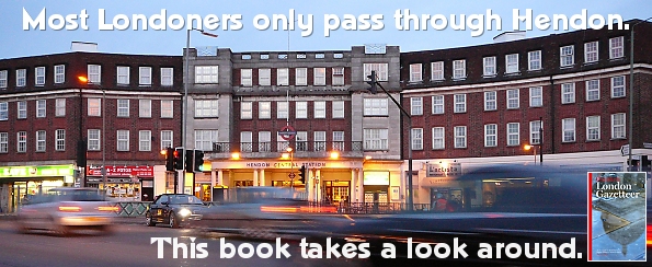
A socially graduated residential district situated three miles north-west of Hampstead. Excavations in 1974 revealed Roman
remains from c.AD300 but Hendon’s name (which means ‘at the high down’) was first recorded in 959, when
it was a hamlet on the brow of Greyhound Hill. The ancient manor and parish of Hendon covered over 8,000 acres, mainly woodland
that thrived on the heavy soil, with small settlements in the clearings. The manor belonged to Westminster Abbey from the
10th to the 16th century and, as the forest was cut down, haymaking became the chief activity. The farmhouse at Church Farm
was built around 1660 and is now a borough museum. During the 18th century, Brent Street acquired several grand houses, along
with the Bell Inn and a cluster of shops around the junction with Bell Lane. Hendon railway station was originally called
West Hendon when it opened in 1868. Modern Hendon took form during the late 19th century as the hamlets around the station, Brent Street
and Church End began to coalesce. A distinct social polarity emerged between the wealthy villas in the Parson Street and Sunny
Gardens area and the working-class terraced houses further down the hill. By the 1890s Brent Street had become Hendon’s
main shopping centre. Hendon Central station opened when the London Underground extension to Edgware was completed in 1923.
Shortly afterwards came the construction of the arterial roads that criss-cross the district, bringing industry and new housing,
especially along the North Circular (A406). In 1931 Hendon was Britain’s most populous urban district. The Hendon Technical
Institute was established in 1939 and is now part of Middlesex University. During the late 1950s and early 1960s the council
pulled down and rebuilt much of the housing stock, preserving the social gradient that begins in the disadvantaged lowlands
of West Hendon and rises to the comfortable undulations of Holders Hill. Thirty per cent of the residents of the Hendon ward
are Jewish.
|
|
|
|
|
|
|
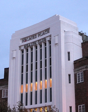
| The former Ambassador cinema, which opened in 1932, is now a Virgin Active health club |
Hendon’s greatest claims to fame are both located on the Colindale side of the M1: the Metropolitan Police Training
Establishment has been instructing London’s cadets since 1935, while what remains of Hendon aerodrome now houses the
RAF Museum.
|
|
|
|
|
|
Postal district: NW4
Population: 15,377 (ward)
Stations: First Capital Connect (Thameslink) (Hendon, zones 3 and 4); Northern Line (Hendon Central, zones 3 and 4)
Further reading: Hugh Petrie, Hendon and Golders Green Past , Historical Publications, 2005 , Historical Publications, 2005
Website: www.hadas.org.uk (Hendon and District Archaeological Society site)

Text and selected images are reproduced with the permission
of Chambers but may differ from the published versions
All content © 2005–2010
|
|
|
|