|
|
 |
|
Hackney/Tower Hamlets
|
|
|
A run-down Leaside industrial area, now divided from the rest of Hackney by the A102(M) East Cross Route. The parish church
of St Mary of Eton with St Augustine was founded in 1880 by Eton College, which wanted to perform charitable work in a poor
part of London. Hackney Wick has a proud history at the heart of east London’s industrial development. Remarkably, the
use of the word ‘petrol’ was pioneered in Hackney Wick, by Carless, Capel and Leonard, who carried on their refining
business here for over a hundred years from 1860, while Matchbox toys were made at Lesney’s factories here from 1947
to 1983.
Much of the area was built up with council housing from the mid-twentieth century. Hackney Wick did not gain its station (originally
to have been called Wallis Road) until 1980, when the North London Line was reopened to passenger services, although there
had been a station at Victoria Park from 1856 to 1943. After a period of stagnation, various disused sites are now undergoing
regeneration and the first steps towards a tentative gentrification have been taken recently with artists buying long leases
on old warehouses. Completed in 2003, St Mary’s Village has replaced the 1960s tower blocks of the Trowbridge estate with a mixed tenure development of houses and flats. A third
of homes in Hackney Wick are rented from a social landlord and another quarter from the council. Five per cent of households
have neither central heating nor sole use of a bath or toilet – the highest proportion in London. It is to be hoped
that Hackney Wick’s proximity to the Olympic Park will stimulate much-needed environmental improvements in this vicinity.
|
|
|
|
|
|
|
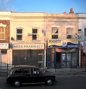
| Dilapidated premises on Wick Road in 2007, showing no sign yet of pre-Olympics revitalisation |
Media centres and the handball arena will be constructed just east of Hackney Wick, on the site of the Arena Field recreation
ground, several commercial premises and the former Hackney greyhound stadium. The basketball arena will replace Bow industrial
park, south of the railway line.
|
|
|
|
|
|
|
Postal district: E9 and E15
Population: 11,049 (Hackney's Wick ward)
Station: Silverlink Metro (Zone 2)
Further reading: Vicki Cattell and Mel Evans, Neighbourhood Images in East London: Social Capital and Social Networks on Two
East London Estates, Joseph Rowntree Foundation, 1999

Text and selected images are reproduced with the permission
of Chambers but may differ from the published versions
All content © 2005–2010
|
|
|
|
