|
|
 |
|
|
|
A fast-growing and affordable Thames Gateway district situated east of Belvedere. Evidence has recently emerged that a forest established itself here after the last ice age, stretching across what became
the Thames to Hornchurch. The name Earhyth, which means ‘muddy landing place’, was first recorded in the seventh
century when lands here were granted to the bishop of the East Saxons. Henry VIII established a naval storehouse at the end
of West Street in 1512. The town briefly flourished as a summer resort in the mid 19th century after the opening of a steamboat
pier, a hotel and the station. Riverside gardens were laid out, with a maze and arboretum. At the same time, the docks brought
industrial growth, which accelerated over the second half of the century, when Erith’s population increased tenfold.
The town filled with terraced housing for workers, while lords of the manor the Wheatley family progressively developed a
high-class suburb in the Lesney Park area. The Wheatleys built a new manor house in Northumberland Heath and created Avenue
Road as a direct route to the town. To the north-west, British Oil and Cake Mills built innovative concrete silos on Church
Manor Way in 1916. In the first half of 20th century the manufacture of armaments and cables were the dominant industries.
Callender’s laid a pipeline across the bed of the English Channel, which was used to supply fuel for the D-Day landings.
As a consequence of its military significance, Erith was the target of heavy bombing during World War II and was radically
redeveloped afterwards. A concrete pier was built in 1957 and the Pier Hotel was demolished to make way for warehouses. More
historic buildings were lost in the 1960s but a few remain, notably the White Hart, St John’s Church and Erith Library.
In 1999 a Morrisons supermarket was built on the site of the old deep wharf, retaining the pier and reviving a disused industrial
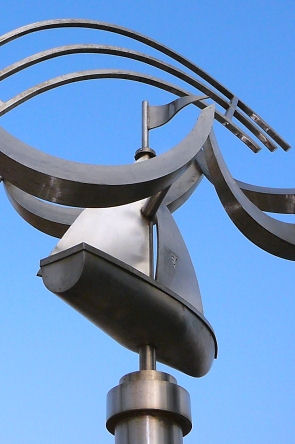
part of the riverside. In 2004 funding was secured for a regeneration scheme that included a public art project (see image
above right). Mainly because of its remoteness, Erith has some of the cheapest property prices in the London area, both for
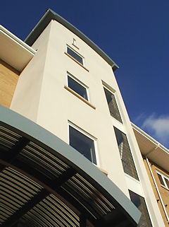
houses and flats. The decline of industry has freed up large areas for residential development and flats, town houses and
maisonettes have sprung up all over the town in recent years (see image below). However, its low-lying situation beyond the
Thames Flood Barrier may make Erith increasingly prone to flooding if global warming causes the expected rise in sea levels.
 |
|
|
|
|
|
|
| Maritime sculpture in Erith town centre |
Alexander Selkirk, the real-life inspiration for Daniel Defoe’s
Robinson Crusoe, arrived back at Erith in 1711 after being rescued from his desert island. He is remembered in the names of
Friday Road and Crusoe Road. The poet Wendy Cope was born in Erith in 1945. Former Conservative prime minister Margaret Thatcher
met her husband Denis while campaigning in Erith in 1950. He was chairman of the Atlas Preservative Company, the family paint
and chemical business.
|
|
|
|
|
|
Postcode
area: Erith DA18
Population:
9,811
Station:
South Eastern Trains (zone 6) Further reading: Frances Sweeny, Memories
of Erith and Crayford, Bexley Education and Leisure Services Directorate, 2002
Text and selected images are reproduced with the permission
of Chambers but may differ from the published versions
All content © 2005–2010
|
|
|
|
