|
A late Victorian urban village in the far north of the borough, tucked between the railway line and the western end of Harrow
Road. Some definitions of College Park’s extent also take in the industrial estates west of Scrubs Lane. There was never
a college here; the name derives from Oxford’s All Souls College, which used to own the land. Its development during
the last quarter of the nineteenth century was stimulated by activity on both sides. To the east, Kensal Green had been built up following the success of its cemetery. To the west, Willesden Junction station had opened in 1866. College
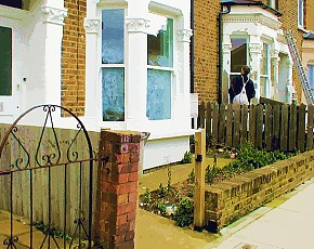
Park has a high population turnover and a wide variety of ethnic minorities. It also has characteristics that make it ripe
for gentrification, so it now presents contrasting aspects: some bay-fronted properties have recently been done up while others
remain run-down; there are smart new live/work units on Waldo Road and tatty shops along Harrow Road. The relatively unspoilt
College Park Hotel is a local landmark; there have been proposals to convert it into flats. The council’s creation of
a College Park ‘home zone’ is intended to make the roads safer by giving people priority over vehicles.
|